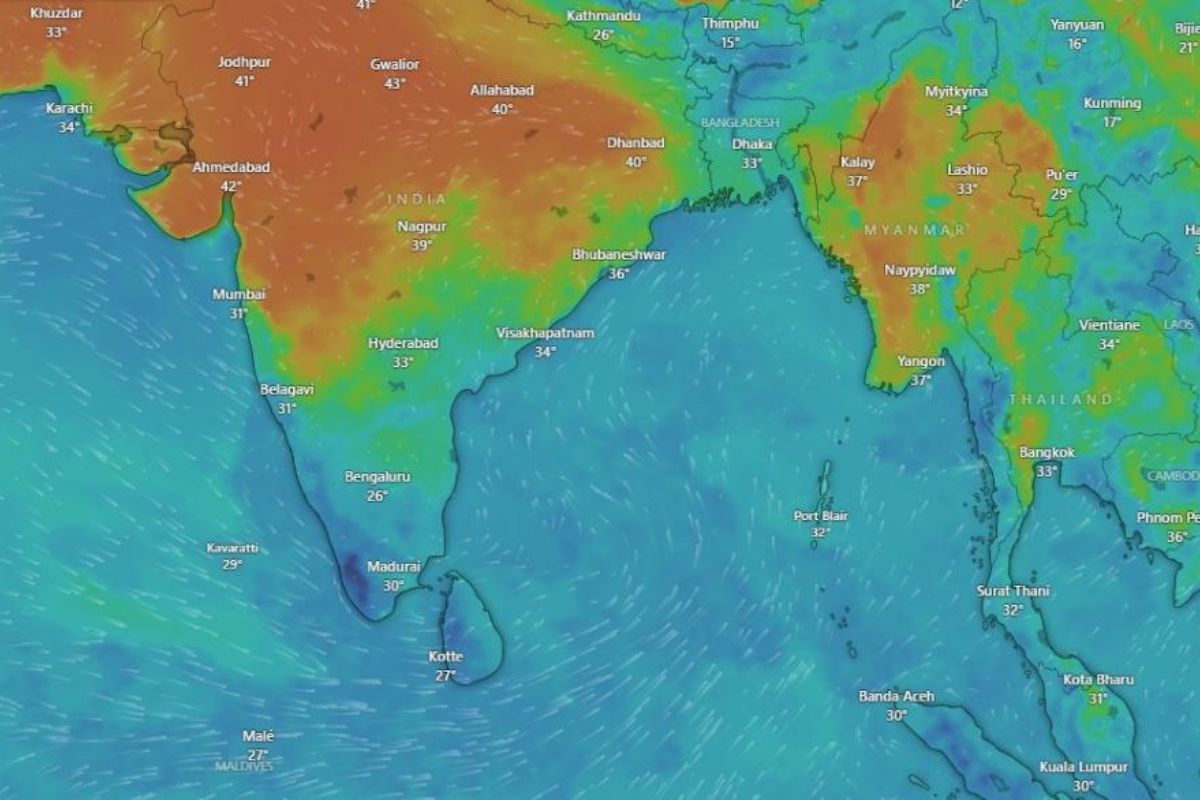
The South West Monsoon (SWM) winds reached the Bay of Bengal on May 19, 2024, three days ahead of the usual date of May 22, according to the India Meteorological Department (IMD).
Earlier, the IMD had predicted that the SWM would hit Kerala on May 31, one day earlier than the typical start date of June 1.
The IMD declares the onset of the SWM over the south Bay of Bengal, south Andaman Sea, and Andaman and Nicobar Islands when certain conditions are met. These include stronger westerly winds, the presence of southwesterly winds, increased cloudiness, and continuous rainfall in the region.
On April 15, the IMD had forecast above-normal rainfall for the SWM season due to the expected La Nina phenomenon in the equatorial Pacific Ocean, positive Indian Ocean Dipole conditions, and less snow cover over the northern hemisphere in the spring and winter of 2024.
The IMD expects seasonal rainfall for the SWM to be 106% of the long period average (LPA) of 870 mm. The LPA is the average rainfall during the monsoon season (June-September) from 1971 to 2020.
There is also a 30% chance of having excess rainfall (>110% of the LPA) and only a 10% chance of below-normal or deficient rainfall. Regarding rainfall distribution during the season, the IMD predicts that most regions, except some eastern parts and the Northeast, will receive good rainfall.
The IMD has not issued a cyclone alert yet. Tamil Nadu and Kerala are on red alert for extremely heavy rainfall between May 19 and May 22 due to a cyclonic circulation in south interior Tamil Nadu and an extended low-pressure region from central Maharashtra to the cyclonic circulation.
The last record-breaking La Nina phenomenon, which lasted from 2020 to 2023, led to extended SWM seasons in 2021 and 2022, causing floods in many Indian states.
Keep Reading
Part 1: Cloudburst in Ganderbal’s Padabal village & unfulfilled promises
India braces for intense 2024 monsoon amid recent deadly weather trends
Support us to keep independent environmental journalism alive in India.
Follow Ground Report on X, Instagram and Facebook for environmental and underreported stories from the margins. Give us feedback on our email id greport2018@gmail.com.
Don’t forget to Subscribe to our weekly newsletter, Join our community on WhatsApp, and Follow our YouTube Channel for video stories.
