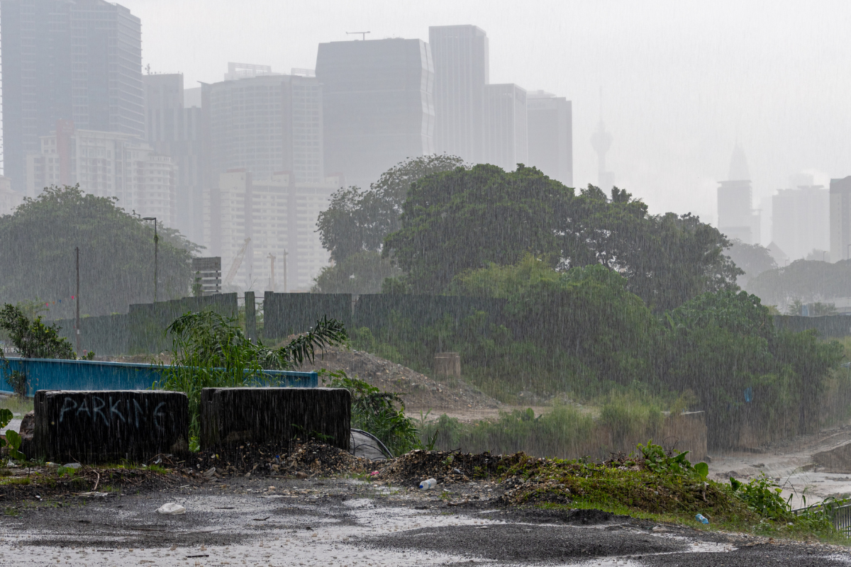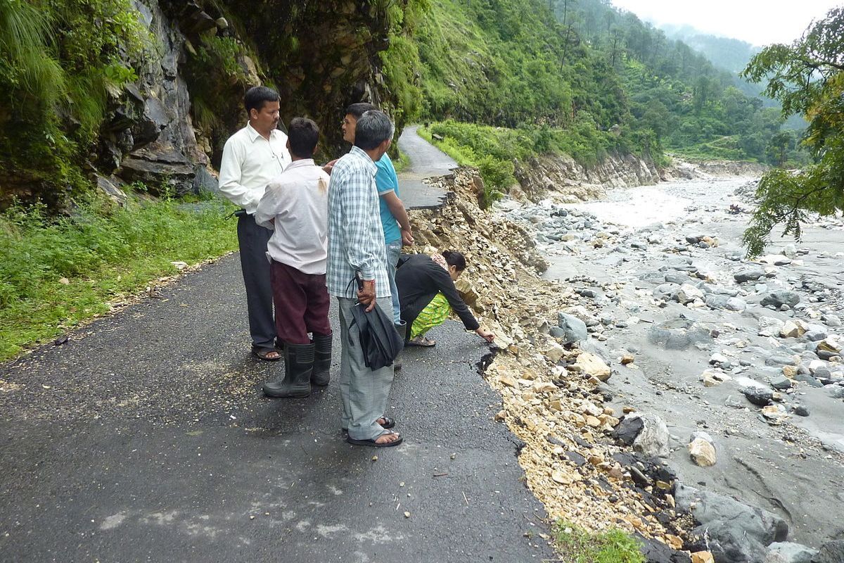
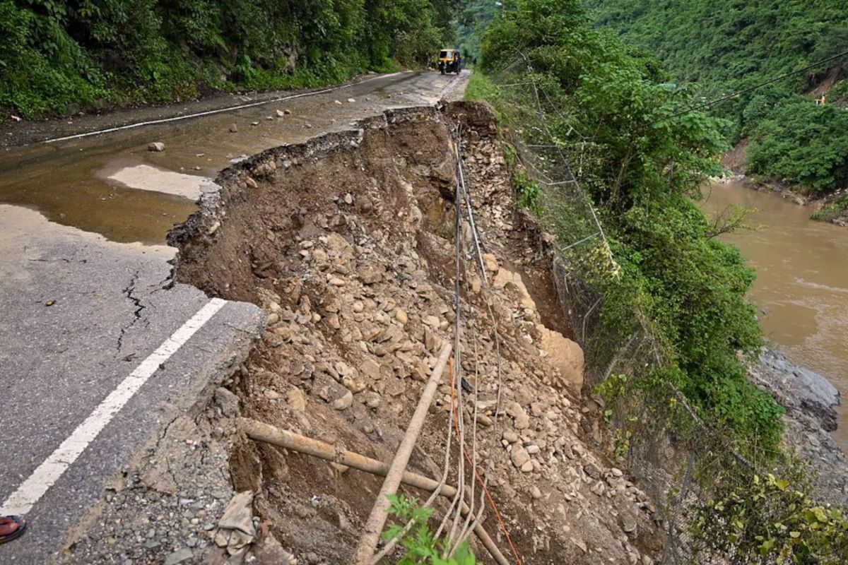
On July 11th, 2024, a massive landslide crashed onto the Badrinath National Highway, just 1 kilometre before Joshimath town. This incident disrupted the Char Dham Yatra and reignited debates about sustainable development in the fragile Himalayan region. The landslide severed connectivity with Badrinath, Joshimath, and other towns, leaving over 3,000 travellers and pilgrims stranded.
Chamoli District Magistrate Himanshu Khurana confirmed,
“Badrinath National Highway (NH) 07 is blocked due to heavy debris falling from the hill in Bhanerpani, Joshimath.”
Uttarakhand’s monsoon triggers widespread landslides
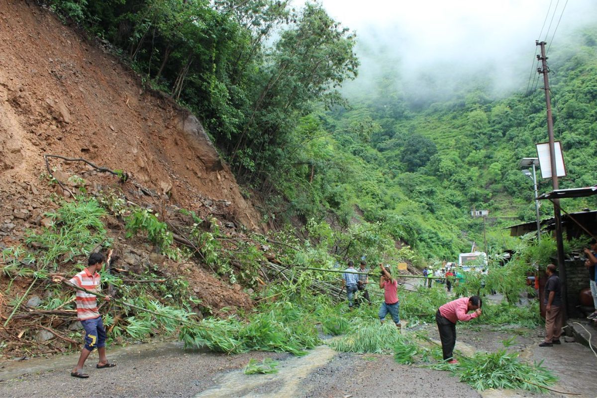
This event is part of a larger crisis in Uttarakhand. Since the monsoon began on June 23rd, 2024, the state has witnessed 1,521 landslides in 17 days. The State Landslide Reduction and Management Center has identified 132 critical locations prone to severe landslides, mostly along the Char Dham Yatra route. An additional 35 new landslide zones have been discovered, posing a constant risk to travellers.
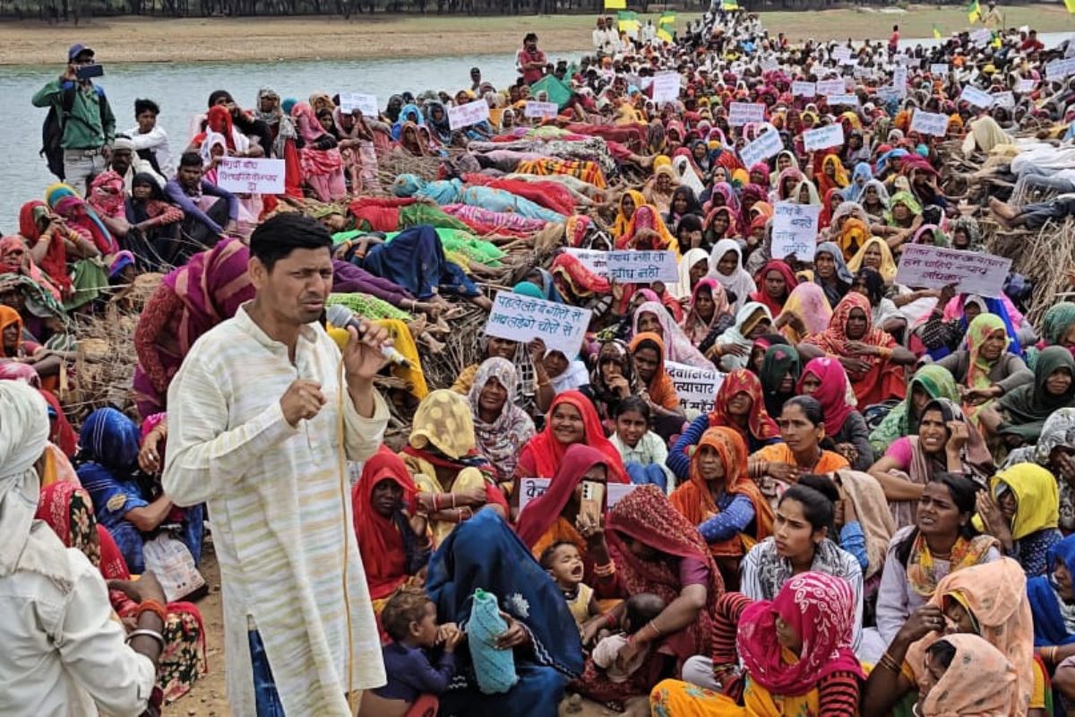
The Badrinath NH, an essential part of the Char Dham road network, is vital for one of Hinduism’s sacred pilgrimage sites and the region’s economy. The route’s importance is highlighted by the rising number of pilgrims. In 2022, the Char Dham Yatra had over 33 lakh visitors, increasing to 56 lakh in 2023, In 2021, 52.93 lakh pilgrims visited the four Dhams, while in 2020, the number was 33 lakh. In 2019, the number stood at 34.77 lakh straining the infrastructure.
There is another side to this rise of pilgrims, or just tourists. Data from the Indian Space Research Organisation (ISRO) reveals a worrying trend. Between 1988 and 2023, Uttarakhand recorded 12,319 landslides. However, the frequency has accelerated recently.
This trend isn’t just statistics. Each event carries the potential for tragedy, like the 2013 Kedarnath disaster that claimed over 6,000 lives.
Government response and realities
Despite claims of being called an all-weather route, government data shows frequent closures of the Char Dham Yatra route due to landslides. From 2018 to 2023, the number of landslides has significantly increased, starting from 216 landslides in 2018 and escalating to over 1,100 in 2023. The yearly figures showed a general upward trend, peaking dramatically in the most recent year. This has prompted scrutiny of official assurances and raised questions about the project’s environmental impact assessment.
Bahukhandi Prem noted,
“In areas like Joshimath, which has been sinking for the past two years and where numerous homes have been declared unsafe, the absence of a comprehensive governmental report detailing the environmental and structural impacts is particularly troubling. This lack of transparency and accountability necessitates a critical review of current policies, pushing for more robust environmental assessments and a balanced approach that does not sideline community safety for infrastructural development.”
Regarding landslide prevention measures, Prem notes, “I’m not a landslide prevention expert, so I can’t suggest solutions. I’ve seen measures taken, like the Government of Uttarakhand has established the “Uttarakhand landslide Mitigation and Management Center” to identify the landslide potential areas and provide sustainable and scientific solutions to mitigate the hazards in many places but they don’t work.”
He adds a sobering example,
“In 2021, an Assistant Professor of Communication at Narendranagar Government College, Manoj Sundriyal, met with an accident and died on the spot when a huge stone fell on his car… it was not even the rainy season.”
The Uttarakhand State Disaster Management Authority advises taking precautions to minimize landslides’ impact. Recommendations include monitoring weather updates before travelling to hilly regions, moving away from likely landslide paths, keeping drainage systems clear, and planting trees to stabilize soil. It’s crucial to be aware of signs like rock falls, building subsidence, and muddy river waters, indicating potential upstream landslides, and to contact local authorities if any signs are noticed.
As per the advice, the government uses Landslide Hazard Zonation (LHZ) maps to identify high-risk areas. The National Disaster Management Authority (NDMA) provides detailed guidelines and a list of do’s and don’ts, such as avoiding construction in vulnerable areas and providing proper first aid before moving injured individuals.
Char Dham Project: Development at what cost?
The Char Dham Highway Project, started in 2016, symbolizes the conflict between development and environmental preservation in Uttarakhand’s Himalayan region. The 900-km project, with a budget of Rs 12,000 crore, aims to develop all-weather connectivity to four pilgrim centres– Gangotri, Yamunotri, Badrinath, and Kedarnath.
In December 2016, Prime Minister Narendra Modi laid the foundation for the Char Dham Pariyojana and dedicated the route to the victims of the 2013 Kedarnath floods. This dedication came despite warnings from environmentalists that over-construction had exacerbated the disaster in 2013. The project had a substantial environmental impact. Nearly 700 hectares of forest land was lost, with 47,043 trees felled, and another 8,888 trees facing the axe. In addition, muck dumping has blocked natural drainage, and vertical hill cutting without proper clearances has led to landslides.
“Essentially, it has always been a single, unified project,” stated Ravi Chopra, director of the People’s Science Institute in Uttarakhand and chairperson of the high-powered committee, which was established by a Supreme Court directive.
Lacks comprehensive impact assessment
Not just this, Char Dham Road Project lacks comprehensive impact assessment. Furthermore, the government maneovered around the rules to make sure that the project goes through. The Ministry of Environment, Forest, and Climate Change requires environmental clearance for National Highways expanding over 100 km, involving additional right of way or land acquisition exceeding 40 metres on existing alignments and 60 metres on re-alignments. The 825 km Char Dham project was divided into 53 smaller projects, each less than 100 km, avoiding the need for environmental clearance.
“Each project is independent, with distinct start and end points, and significant locations on highways. There was no requirement for an Environmental Impact Assessment (EIA) for these projects,” said Union Minister for Road Transport and Highways Nitin Gadkari in the Rajya Sabha, responding to Rashtriya Janata Dal MP, A.D. Singh.
Bahukhandi Prem, an Environmental Activist and Managing Trustee of Friends of Himalaya, sheds light on the lack of comprehensive impact assessments for the project,
“I’m not aware of any official government assessment of the Char Dham Road Project. However, experts, especially geologists, have consistently raised concerns. The project has inadvertently created new landslide-prone areas, despite its intention to reduce such incidents”.
He adds, “In bits and pieces, many people, including myself, have worked in some places. Water sources have dried up in some villages near RudraPrayag. Joshimath is sinking due to unplanned construction, overpopulation, obstruction of water flow, and hydroelectric activities. The bypass to Badrinath is another important factor. The water sources, pastures, and agricultural land of many villages are in danger due to this road and landslides.”
Legal challenges face Char Dham project
The Char Dham project has faced legal challenges since its start. In 2018, an NGO challenged the road-expansion project for its potential impact on the Himalayan ecology. The Supreme Court formed a committee under environmentalist Ravi Chopra to examine the issues.
In September 2020, the Supreme Court upheld the recommendation to limit the carriageway width to 5.5 m (with a 1.5 m raised footpath). However, the Ministry of Defence appealed for wider roads for strategic purposes. The legal battle continues, with no final judgment on the road width issue as of 2024.
“The mountains are angry. We’ve disturbed them too much, and now they’re fighting back,” says Bashir Ahmad, a 38-year-old shopkeeper in Joshimath. “I’ve lived here for 12 years but never seen the land so unstable. The Badrinath road has been blocked for over 48 hours. Our lifeline is cut off.”
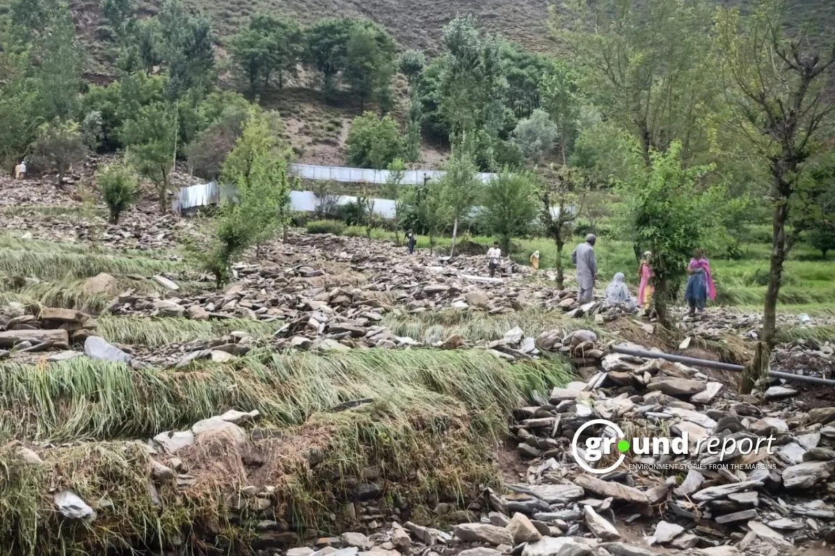
The situation in Joshimath and surrounding areas of the project is dire. Indian scientists predict that land displacement in Joshimath and nearby Bhatwari could “aggravate” significantly, with an accumulated displacement of 20-25 meters due to seismic factors.
The Dehradun-based Wadia Institute of Himalayan Geology has assessed 51 percent area of Uttarakhand is located in “high” and “very high” landslide-susceptible zones and the state Public Works Department has confirmed 333 landslide-prone areas as “danger zones” in the state.
Road project in Himalayas caused damage
Prem offers potential solutions, “The solution we suggested was to respect the Himalayas, especially the new and fragile Himalayas, and adhere to a 5.5-meter road width. If you are willing to spend such a huge amount, 15,000 crores, then you can build a new road just 25 kilometers away from the current one. The new road can be constructed with the best knowledge we have together”.
He continues,
“But at the time, the system didn’t respect activists or independent scientists and built the road with DLPS (Double Lane Paved Shoulders, i.e., two lanes of 5 meters each, plus one-meter pavements on both sides). They made many vertical or near-vertical cuts without sufficient slope vulnerability analysis in the fragile Himalayas. This is the main reason for landslides.”
Prem concludes the assessment, “So, now we have only one solution: leave the road as it is today and apologize to nature. They have already caused irreversible damage to the fragile geology and sensitive ecology of the Himalayas.”
As per Bahukhandi Prem, Geologists warn that such landslide-prone areas will continue to pose challenges for Uttarakhand over the next 30 years, suggesting that the repercussions of such ambitious projects have not been fully addressed.
When asked about similar projects and their impacts, Prem emphasizes the unprecedented scale of the Char Dham project, “It’s our biggest project, spanning 889 kilometers, covering Gangotri, Yamunotri, Kedarnath, Badrinath, and Hemkund Sahib. Are you aware of the Silkiyara tunnel mishap and the Totaghati landslide last year on this route?”
The Road Ahead
As Uttarakhand faces this critical moment, today’s decisions will shape the future of the Badrinath highway, the Char Dham project, and the region. The challenge is immense, but there’s an opportunity to set a new standard for sustainable mountainous development.
Dr. Anil Joshi, a prominent environmentalist from Uttarakhand, emphasizes the need to rethink Himalayan development. It’s not just about building roads and accommodating tourists, but also considering the ecosystems’ capacity.
The fate of the Badrinath highway and the Char Dham project is uncertain. The Himalayan ecosystem, stressed by climate change and human activity, faces an uncertain future. The urgent need for a balanced approach that respects development needs and ecological preservation becomes increasingly clear.
Keep Reading
Part 1: Cloudburst in Ganderbal’s Padabal village & unfulfilled promises
India braces for intense 2024 monsoon amid recent deadly weather trends
Support us to keep independent environmental journalism alive in India.
Follow Ground Report on X, Instagram and Facebook for environmental and underreported stories from the margins. Give us feedback on our email id greport2018@gmail.com.
Don’t forget to Subscribe to our weekly newsletter, Join our community on WhatsApp, and Follow our YouTube Channel for video stories.