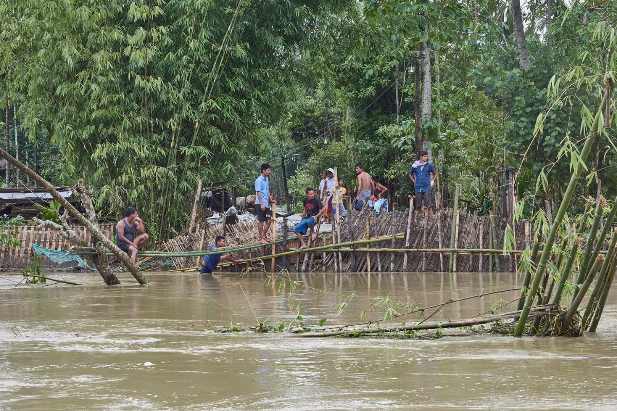
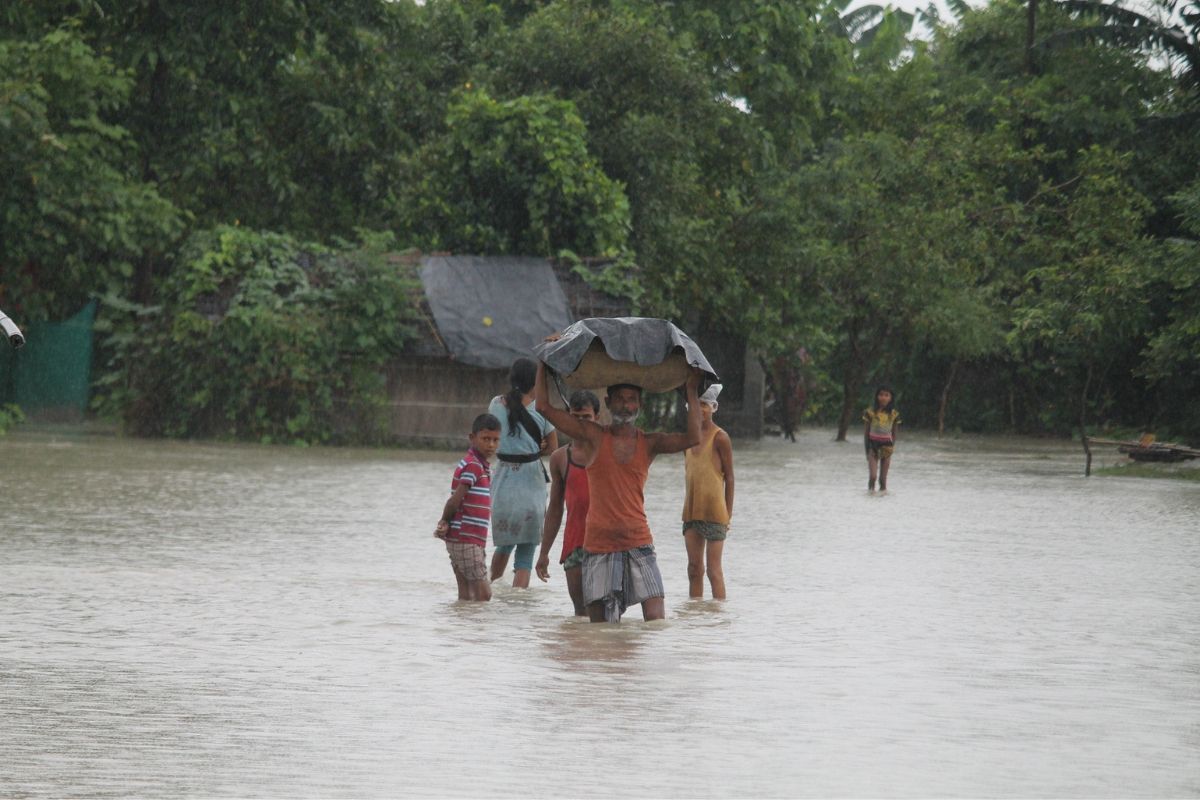
The floods in Assam have grown more severe and frequent in recent years, causing damage to lives and livelihoods. This year’s floods have affected over 2.5 million people across 30 districts, with major rivers flowing above danger levels.
The unpredictable Brahmaputra River shapes Assam’s flood landscape, originating in the Tibetan plateau, and flows through Arunachal Pradesh and Assam before emptying into the Bay of Bengal. The river is joined by substantial tributaries from neighbouring states and countries. This river system is vital for the region’s ecology and economy but makes Assam susceptible to annual flooding.
Chief Minister Himanta Biswa Sarma said the next few days could be “critical” as India’s weather department predicted more rainfall. Sarma said the state was experiencing a “second wave of flooding” due to heavy rainfall in neighbouring Arunachal Pradesh and some Assam districts. He added that the coming three to four days could be critical, depending on the rains.
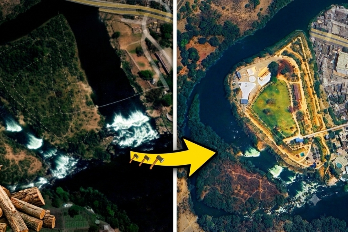
Importantly, over the past seven decades, human interventions have worsened these floods. Embankments, encroachments, and deforestation contribute to the issue. Silt from high-altitude areas forms sandbanks and islands. Settlements have developed in these areas, obstructing the river’s natural path.
Dr. Arup Kumar Sarma, Professor at IIT Guwahati, points to infrastructure challenges: “Old and poorly maintained flood control structures worsen flooding with frequent breaches.“
History and devastation caused by Brahmaputra floods
According to the Rashtriya Barh Ayog, almost 40% of Assam’s land is flood-prone, nearly four times the national average. According to the ASDMA, major floods have occurred in Assam in 1972, 1974, 1978, 1983, 1986, 1988, 1996, 1998, 2000, 2004, and 2012. Since then, there have been annual flash floods and long-term inundations in 2018, 2020, 2021, 2022, and 2024.
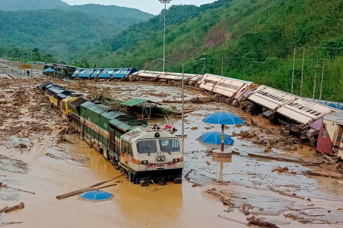
Historical data shows a troubling trend of rising flood impacts. From the 1950s to the early 2000s, the average annual flooded area and affected cropland increased. The number of affected people surged from 860,000 to over 4.5 million in the early 2000s. The economic damages increased more than 120-fold, annually. According to the Assam State Disaster Management Authority (ASDMA), 838 people died in floods from 2013 to 2022. The toll peaked in 2022 at 181 flood-related deaths – the highest in a decade.
Dhubri, Darrang, Cachar, Barpeta, and Morigaon have faced heavy flooding in recent years. In 2022, Cachar district was among the worst affected, with over 500,000 people impacted, and Dhubri saw over 775,000 residents affected. Severe flooding in low-lying areas along the Brahmaputra valley is common.
Over 50 tributaries feed the river, supplemented by melting glaciers during the summer, and heavy monsoons, causing overflow. Nayan Sharma, an adjunct professor at the Indian Institute of Technology, Roorkee, said, “The Brahmaputra basin gets an average annual rainfall of 1400-6000 mm, while Tibet gets barely 400 mm. The bulk of the flood flows are generated in India, while the Yarlung Tsangpo conveys the snowmelt streamflow from the Himalayan glaciers.”
In 2022, research showed increasing pre-monsoon and monsoon rainfall in Assam, with statistical significance. Post-monsoon and winter rainfall showed decreasing trends but they were not statistically significant.
“There are 4-5 floods every year in Assam, but some years have longer seasons. This is happening more frequently now and last happened in 2022,” said Dr. Partha J. Das.
Yearly Impact
According to ASDMA data, 160 human deaths were reported in 2017, 122 in 2020, and 102 in 2019. The 2024 floods affected 2.45 million people across 30 districts, with 52 flood-related deaths. In 2023, 20 districts were impacted, including Nalbari, Baksa, Lakhimpur, and Tamulpur. In 2022, 35 districts were affected across three major flooding waves, impacting over 9 million people.
In 2021, 31 districts were affected, impacting over 5.8 million people and claiming 169 lives. In 2020, 30 districts were affected, impacting over 5 million people and causing 122 flood-related deaths. Recent flood data reveals the escalating Assam flood crisis.
“Very heavy rainfall in a short period is becoming the norm in a region known for continuous light drizzles. Our existing infrastructure isn’t equipped to handle such weather anomalies,” emphasized Rituraj Phukan, a climate activist and founder of the Indigenous People’s Climate Justice Forum, an NGO based in Assam.
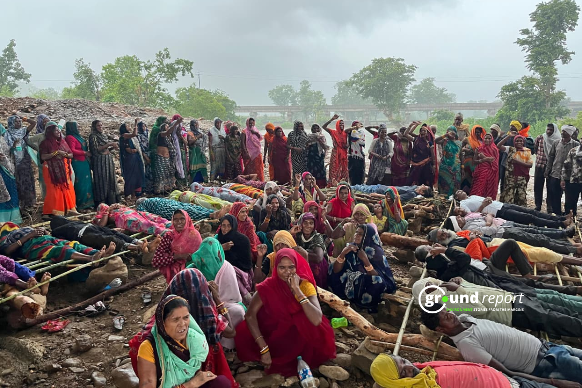
Phukan pointed out, “Floods and erosion frequently force people into daily wage labour or drive migration to cities, where men often find work in hotels and restaurants. Women, however, have fewer and more restricted options.”
District Vulnerability
While flooding affects large parts of Assam, some districts consistently experience the worst devastation. Several districts in Assam regularly face severe flooding. Dhubri, where two rivers meet, saw over 775,000 people affected in 2022. Barpeta, a low area, had more than 1 million people impacted that same year.
Morigaon, close to the Brahmaputra River, is always one of the worst-hit areas. In southern Assam, Cachar suffered flooding that affected over 500,000 people in 2022. Darrang in northern Assam sees hundreds of thousands affected by floods each year. Goalpara in western Assam faces both flash floods from nearby hills and river flooding. Lastly, Lakhimpur in northeastern Assam deals with flooding from local rivers.
The repeated devastation in these districts underscores the need for long-term flood mitigation strategies. Dr. Partha J. Das said, “Global warming intensifies the monsoon and increases extreme rainfall events in Assam, amplifying flood impacts with local environmental degradation.”
What is intensifying floods?
Since the 1950s, Assam has built 423 embankments along the Brahmaputra River and its tributaries. 295 of them have outlived their intended lifespan, causing regular breaches, damage, and destruction. In addition, Gaon Connection reported, according to geographers, deforestation is the primary factor in worsening floods in Assam. “Deforestation and haphazard hill-cutting are two significant causes of floods in Assam,” retired professor Abani Kumar Bhagabati of Gauhati University said.
He explained “Deforestation drives soil erosion, as trees and their roots play a crucial role in holding the soil and providing shelter from wind and rain. When forests are destroyed, the land is left unprotected and exposed to the weather, making it susceptible to being washed or blown away”.
Rising global temperatures intensify the monsoon and extreme rainfall, and this impacts Assam as well. Dr. Partha J. Das, an environmentalist and Head of the Water, Climate & Hazard Division at Aaranyak, an environmental non-profit said, “Climate change makes the monsoon erratic and intense, overwhelming Assam’s rivers. Deforestation in the Eastern Himalayas has reduced the soil’s rainwater absorption capacity, increasing surface runoff and soil erosion, amplifying flood impacts”.
Impact
Climate change worsens floods in Assam, increasing water-related events. River-bank erosion, wetland degradation, deforestation, and unsustainable riverbed mining exacerbate the situation. Dam-induced flash floods from hydropower projects occur annually.
Erosion has deposited silt, reducing riverbed capacity. Dr. Arup Kumar Sarma, an environmental scientist, notes, “Sedimentation has raised riverbeds, causing rainfall to overflow riverbanks… Old, poorly maintained embankments meant to protect flood-prone areas lead to frequent breaches and worsen nearby flooding.”
Arup added, “The loss of wetlands as natural flood barriers has reduced the landscape’s ability to mitigate floods. Haphazard construction in floodplains and encroachment of river channels have obstructed natural drainage, worsening urban flooding.”
Assam floods: vulnerability analysis
An analysis of flood vulnerability in Assam shows complex risk and preparedness patterns. This data provides insights for targeted flood management, considering flood impact, demographic flood-proneness, infrastructure access, and preparedness.
Barpeta district is a concern according to the Climate Risk and Vulnerability Assessment. The Barpeta revenue circle has a vulnerability score of 1, and a preparedness score of 0.88, suggesting high susceptibility to flood impacts. Sarthebari and Kalgachia have high flood impact scores but lower vulnerability, indicating better resilience.
Nalbari and Nagaon districts, represented by Barkhetri and Kampur revenue circles, have moderate flood impact and vulnerability scores, suggesting a balanced flood risk and preparedness situation. Preparedness levels are high, with most revenue circles scoring above 0.7. However, high preparedness doesn’t always correlate with lower vulnerability scores, highlighting complex factors in flood resilience. Infrastructure access varies significantly, from 0.39 in Silchar to 0.84 in Chenga, indicating disparities affecting flood response capabilities.
The data shows significant demographic flood-proneness variations, with scores ranging from 0.02 in Jalah to 0.71 in Silchar, highlighting diverse population vulnerabilities to flooding in Assam.
Flood management, and more
Despite some improvements to early warning systems, many flood-prone areas still lack robust alert mechanisms, leaving communities vulnerable to sudden inundations. The flood situation in Assam is worsened by limited inter-state and international cooperation, with upstream activities in neighbouring states and countries significantly affecting water flow, and coordinated efforts to manage these impacts are inadequate.
In recent years, there have been positive developments in Assam’s flood management. The Assam State Disaster Management Authority (ASDMA) has collaborated with tech initiatives like CivicDataLab to develop data models for improved flood preparedness and response. In 2023, Assam introduced a ‘green budget’ with funds for climate change action and disaster risk reduction.
Despite annual funds and resources, Assam struggles to manage its floods. Many flood control structures, like embankments, were built decades ago and have fallen into disrepair due to a lack of maintenance or upgrades. There’s a lack of long-term planning, prioritising short-term relief over comprehensive flood mitigation strategies. According to ICIMOD research, floods prompt short-term rescue and relief rather than long-term rehabilitation and mitigation, leading to a perception of these events as normal for Brahmaputra basin communities, despite increasing flood frequency and intensity.
Keep Reading
Part 1: Cloudburst in Ganderbal’s Padabal village & unfulfilled promises
India braces for intense 2024 monsoon amid recent deadly weather trends
Support us to keep independent environmental journalism alive in India.
Follow Ground Report on X, Instagram and Facebook for environmental and underreported stories from the margins. Give us feedback on our email id greport2018@gmail.com.
Don’t forget to Subscribe to our weekly newsletter, Join our community on WhatsApp, and Follow our YouTube Channel for video stories.