Ajay Singh, resident, said, “Compared to last year, more cracks have been noticed in the lands. In Lindur village, so many cracks have developed. We can’t do flood irrigation. It’s a request to the administration to provide us with sprinkle pipes. We can only request the administration to save our crops from damage.”
Lindur villagers are anxious about increasing cracks hindering traditional flood irrigation and threatening agricultural yields.
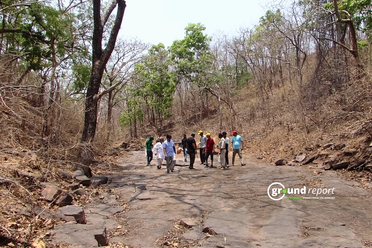
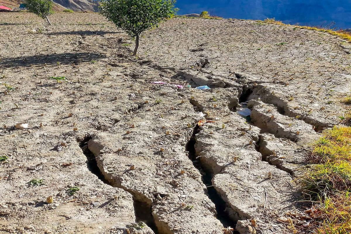
Lindur, a small village in Himachal Pradesh’s Lahaul-Spiti district, is dealing with severe land subsidence. This is leading to ground cracks, disrupting local farming, and prompting villagers to seek urgent help from authorities. At 10,800 feet, Lindur village is worse off than last year. In October 2022, 7 out of 14 houses developed cracks, with 4 immediately declared unsafe.
Himachal Pradesh State Geologist Sanjeev Sharma speaking to Ground Report said,
“The prolonged wet spell, spanning over five months, caused supersaturated soil and land subsidence. The combination of winter, followed by summer, and deforestation exacerbates the issue. The rainy season brings short, intense rainfall without protective cover, causing last year’s landslides.”

Vulnerability
The state has over 17,000 landslide-prone sites, with Sirmaur and Chamba districts being the most vulnerable. In recent years, major landslides have increased six-fold from 2020 to 2023. Climate change is expected to worsen these issues, with projections indicating temperature rises of up to 5°C by 2030.
The problem isn’t just in remote areas; 675 landslide-prone sites are near critical infrastructure and populated areas. Districts like Chamba, Mandi, and Kangra are at risk. Several villages, including Jhandota in Chamba and Bariara in Kangra, are grappling with active landslides or land sinking.
The preliminary report from IIT Mandi shows significant ground cracks and land subsidence in Lindur village. The cracks, varying in width, depth, and length, predominantly affect agricultural land and slopes.
Sarita, Pradhan of Goharama Gram Panchayat told Ground Report,
“Cracks were noticed in the village periphery a few days ago. Last year the same thing happened in this village and 14 houses have developed cracks and four are unsafe. Water seepage from the Jahmala nullah, which floods annually, may be causing the cracks.”
As per the reports, Cracks are mainly seen on agricultural land and slopes, varying in width, depth, and length. Two locations near Lindur village, 250 to 300 metres away, are frequent landslide sites.
Nitin Sharma, Training & Capacity Building Coordinator for the District Disaster Management Authority in Lahaul & Spiti, emphasised that there are no immediate plans to relocate the 14 affected families, but authorities are considering various scenarios. “These decisions involve complex revenue matters and need careful consideration. We are looking into the state’s implementation policies and calculating all aspects of potential relocation,” he said.

Region’s unstable geology increases vulnerability
Nitin Sharma told Ground Report,
“The region’s vulnerable topography is prone to sinking due to alluvial fans and glacial deposits. Alluvial fans are cone-shaped deposits of sediment formed by flowing water, while glacial deposits are sediments left behind by retreating glaciers. The village sits atop glaciers, and the meltwater penetrates the region. This glacial melt is now the primary water source, increasing vulnerability.”
He said, “There’s a stream called Jahalma Nala that erodes the village’s toe, causing it to slide. It’s a large area prone to slippage.”
The IIT Mandi report identifies leakage from five canals above the settlement as a contributing factor, worsening the soil’s supersaturation and increasing instability. Water seepage from the annually flooding Jahmala nullah is likely significant, and requires confirmation through detailed geological surveys.

Sharma noted, “We’ve conducted studies and have a report from the Geological Survey of India, and regular field monitoring. The place moves in large timescales, but in the last few years, the speed might have increased.”
Earthquakes, and climate change worsen risks
The region experienced numerous small earthquakes from 1900 to November 2023, including one of magnitude 7, two of magnitude 5, and 33 of magnitude 3-4. This seismic activity, combined with the village’s location on weak soil, increases the risk of water pathways forming underground and landslides.
The report states that climate and seasonal impacts are significant contributors. A prolonged wet spell, lasting over five months, has led to soil supersaturation. This, combined with deforestation and the winter-to-summer transition, has weakened the soil structure, making it more prone to subsidence. Intense, short-duration rainfall during the rainy season, without protective cover, has worsened the landslide risk.
According to the preliminary investigation report, soil temperature significantly impacts rock glaciers, influencing deformation, crack formation, erosion, and subsidence. Rising soil temperatures can accelerate ice melting within rock glaciers, increasing meltwater production. “Changes in soil temperature can affect permafrost stability within the rock glacier, potentially inducing permafrost degradation and subsidence,” the report states.
The report mentioned that climate change impacts, like increased glacial melt and more frequent extreme weather, are worsening the situation. The State Geologist emphasised the need for constant monitoring of the glacier’s melt and irrigation arrangements. If the danger increases, the village may need to be relocated.
Government response and future plans
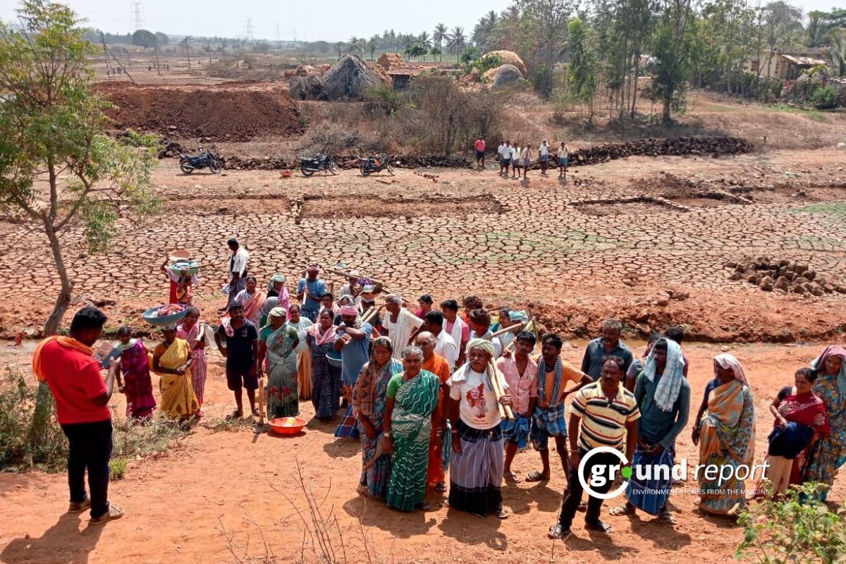
The situation in Lindur village isn’t isolated. A report by the state emergency operation cell of the disaster management authority revealed that 201 villages in Himachal Pradesh are experiencing land subsidence. Solan district has 51 affected villages, followed by Mandi with 46 and Chamba with 41.
Nitin Sharma speaking to Ground Report outlined the government’s approach to the crisis, “Our response has two aspects. First, we have rescue and relief measures based on budget requirements. We have identified safe locations and plans to move people if needed.”
He continued, “Secondly, we’re considering long-term planning. It requires a comprehensive strategy as people may have to leave their ancestral homes, which might be over 100 years old. This is a difficult decision for them. We are discussing how the rehabilitation process would be shared with the state government.”
This issue highlights the need for geological surveys and sustainable development in India’s mountainous regions. The communities like in Lindur village show the balance between human settlements and the Himalayan ecosystem.
Experts warn that natural habitats and human settlements in vulnerable areas will suffer irreparable damage without sustainable solutions. The report calls for a comprehensive geological survey to confirm the causes of subsidence and develop a long-term mitigation plan, including an analysis of soil composition, water pathways, and seismic activity. Measures should be taken to control water seepage from the canals and the Jahmala nullah, such as repairing leaks, diverting water flow, and implementing proper drainage systems.
The preliminary investigation report recommended using slope stabilization techniques like retaining walls, terracing, and reforestation to reduce landslide risks, stabilize the soil, and prevent erosion. Install monitoring systems to track soil movement and water levels for early warning signs, aiding in timely evacuation. Community engagement and awareness programs are crucial for effective mitigation.
As Himachal Pradesh deals with this crisis, the nation watches the state and central governments’ response. The lessons and actions in Lindur and other affected villages could set precedents for addressing geological hazards in the Himalayan region, potentially influencing policies and practices in vulnerable mountainous areas in India and beyond.
Keep Reading
Part 1: Cloudburst in Ganderbal’s Padabal village & unfulfilled promises
India braces for intense 2024 monsoon amid recent deadly weather trends
Support us to keep independent environmental journalism alive in India.
Follow Ground Report on X, Instagram and Facebook for environmental and underreported stories from the margins. Give us feedback on our email id greport2018@gmail.com.
Don’t forget to Subscribe to our weekly newsletter, Join our community on WhatsApp, and Follow our YouTube Channel for video stories.