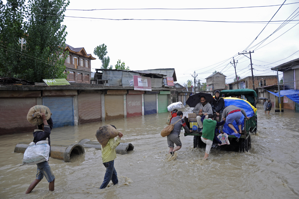
Anxiety regularly fills the lives of residents living in and around the catchment areas of the Jhelum River. The river Jhelum, which drains more than half of the valley, was flowing close to the flood alarm level in the last week of April. With the flood threat looming large, it brought flashbacks of the 2014 floods, when the entire valley was ravaged by the roaring river that has forever nurtured it.
This is in total contrast to January, when the water levels in Jhelum reached their lowest. The river was flowing at -0.75 feet at Sangam (Anantnag) and -0.86 feet at Asham (Bandipora) in January. The level at Sangam had previously fallen to such low levels in November 2017.
Viral videos and photographs ‘flooded’ the internet, with the iconic Kashmiri houseboats standing on dry land. The pictures sent shockwaves throughout the valley. The valley had recorded a 79% rainfall deficit for December. The daytime temperatures in Kashmir Valley were higher than those in Delhi.
For more than a decade, there has been a pattern to this unpatterned precipitation in the valley. An independent weather forecaster and analyst, Faizan Arif said that the winter precipitation over the last few years has shown a declining trend. “For the last 4-5 years, we have mostly received below-normal rainfall and precipitation in winter… in 2021–22 winter, we had a 9% deficit; another year, 37%,” he added. In 2023, Jammu and Kashmir received 1,146.6 mm of rainfall, 7% below the average of 1,232.3 mm.
Faizan said that things were only going to get worse. Since 2014, Kashmir Valley and Srinagar City in particular have seen the government declare floods almost every single year without fail, a fact also alluded to by Faizan. “Since the 2014 deluge, we saw Jhelum cross flood declaration level 5 times in 2015, then once each in 2016, 17, last year, and this year.”
This year also, as per Faizan, the rainfall has been excessive in April. “The issue is that most of the precipitation happens in one go. The distribution pattern that is expected to deposit rain and snow gradually over, say, a month, is altered and takes place in a matter of days.”
“There is no choice other than accepting the fact that this is going to be a recurrent phenomenon. It is only going to get worse. 2023 was the warmest year that Earth ever saw, and 2024 is slated to break that record too. What we are seeing is unprecedented. In January this year, Gulmarg, a winter wonderland, was completely dry. It is unheard of. Winter is not ‘wintering’ enough. Summer is ‘summering’ too much,” Faizan cautioned.
Is urbanization to blame?
However, Raja Muzaffer Bhat, an RTI activist who is known for consistently raising his voice on environmental issues, believes that climate alone is not to blame. He said that the haphazard planning of cities and towns is also responsible for the consistent flood threats over the past few years.
“The erratic weather pattern is not a new phenomenon. It used to happen before as well. But now the situation is different. Population growth has led to rapid urbanization, because of which the available land has shrunk and agricultural land holding have decreased. What we see is the impact of these mindless interventions.”
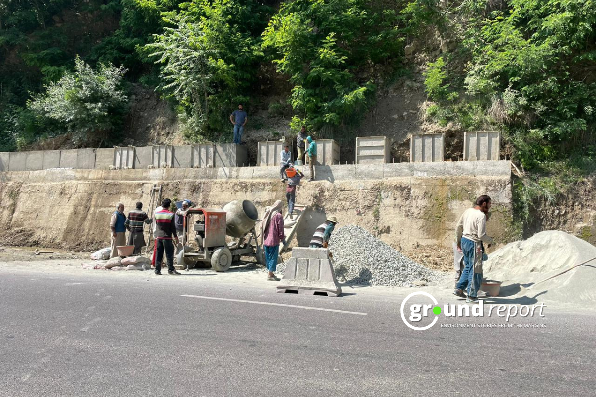
He lamented the erasure of natural water pathways and drainage systems such as wetlands, and flood plains from the landscape, which would act as buffer zones to absorb extra flood waters during times of need. Raja also blamed the government for its ineptitude and lackadaisical approach. Referring to the Jhelum-Tawi floodwater recovery plan, drafted after the 2014 floods, to chart out a pathway for restoring the original carrying capacity of the river Jhelum, he said, “The money was not properly utilized.”
“We’re heading towards a disaster if drastic steps are not taken to tackle these situations,” he said.
A paper published in the ‘International Journal of Disaster Resilience in the Built Environment’ in its study found that
“approximately 46 per cent of the city, comprising 33 municipal wards, is at high risk, while rest of the area, i.e. 17 and 37 per cent, exhibit moderate and low levels of risk, constituting 23 and 12 municipal wards, respectively. The municipal wards expressing high risk may likely witness comparatively more damage (impact) during any future flood event. Thus, there is a need for planned interventions (structural & non-structural) to minimise the emergent risk.”
Another research paper published in 2019 titled ‘Flood frequency analysis of river Jhelum in Kashmir Basin’ noted that in the Jhelum floodplain, the flood management strategies have not gone beyond rescue and relief arrangements and other post-flood measures.
Keep Reading
- Story of Kegu, a tribal of Jhabua suffering from Sickle Cell Disease
- Delhi-Mumbai Expressway: What did the tribals get from this path of development?
- PM Matsya Sampada Yojana falling short in Bhopal?
- Heatwave takes a toll on women agricultural labourers in MP
Follow Ground Report for Environmental News From India. Connect with us on Facebook, Twitter, Koo App, Instagram, Whatsapp and YouTube. Write us on GReport2018@gmail.com and subscribe our free newsletter.
Don’t forget to check out our climate glossary; it helps in learning difficult environmental terms in simple language.