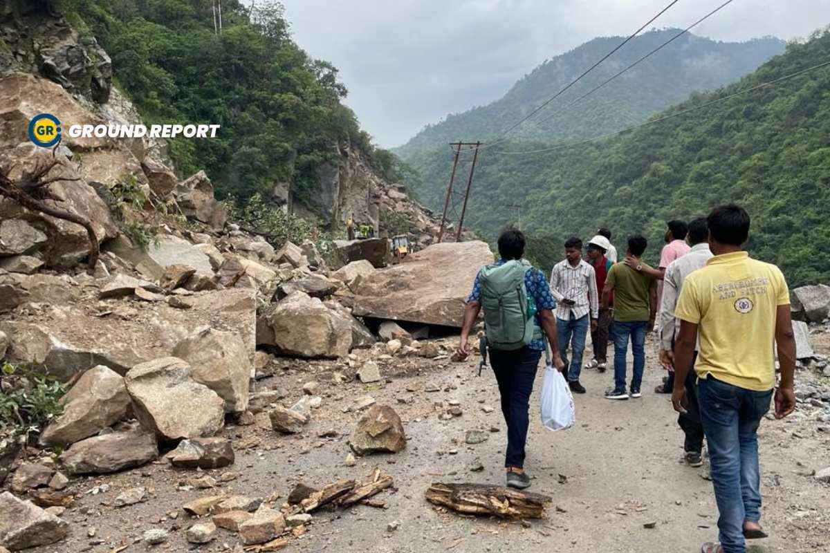
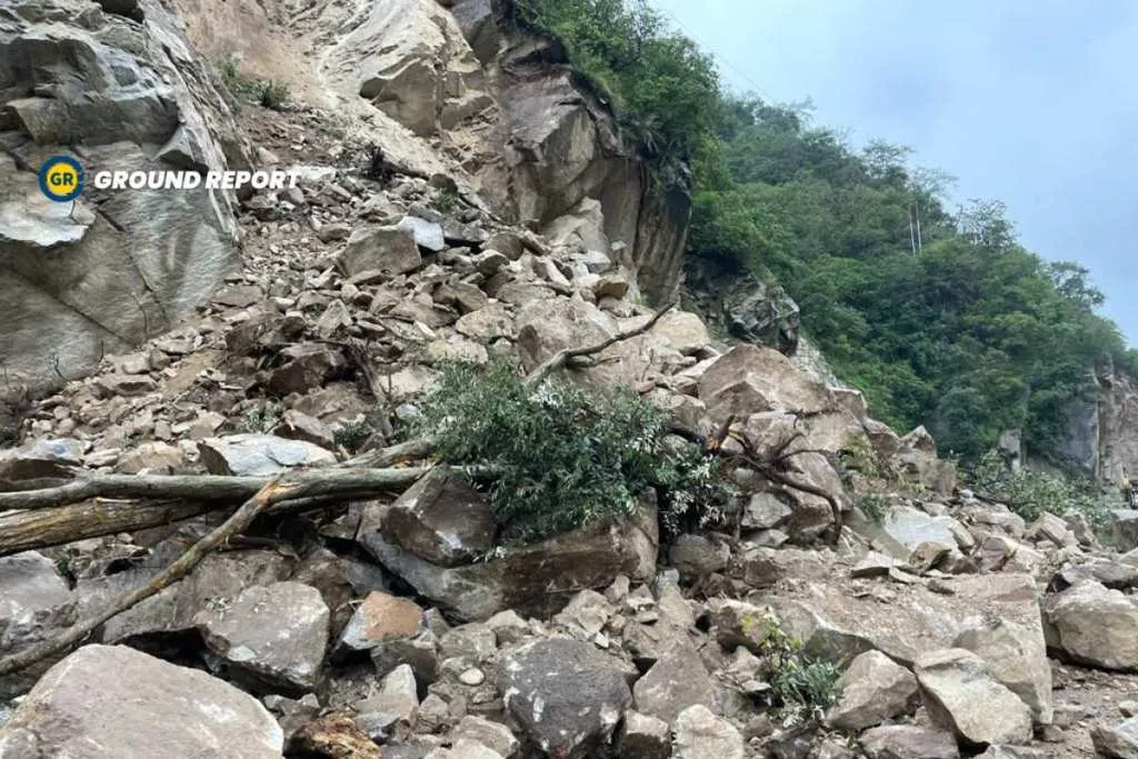
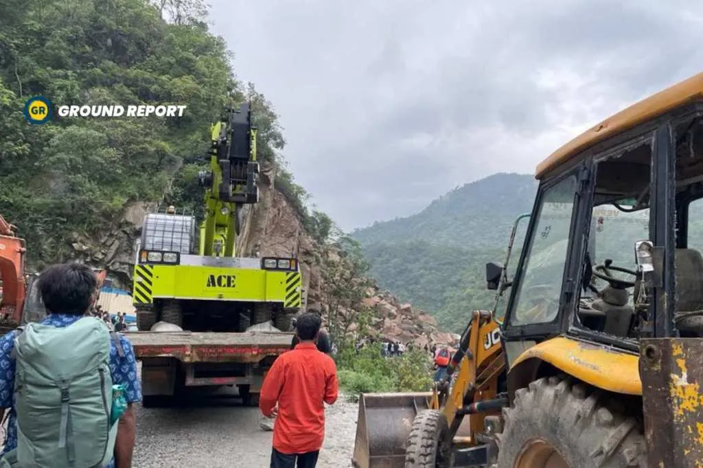
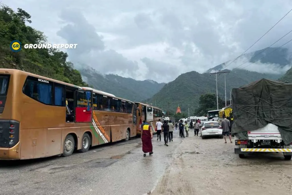
Recently, I visited Tirthan Valley in Himachal. However, while returning from there, I discovered that a landslide had occurred in Mandi near Pandoh on the road NH-3 leading from Manali to Delhi. As a result, our bus was unable to proceed, and we found ourselves stranded for 12 hours. To our dismay, we later learned that another landslide had occurred ahead of us, adding to our waiting time. Approximately 2000 tourists, including myself, were stuck on the road for nearly 24 hours. Thankfully, the army eventually cleared the road, allowing us to return home. Unfortunately, this was not the first time I had experienced such an ordeal, as I had previously spent 12 hours in a bus due to a landslide near Mandi last year as well.
Landslides in Mandi are common
After returning home, I conducted some research and discovered that the incidence of landslides in Himachal Pradesh has multiplied by six in the last two years. In the year 2020, a mere 16 landslides were reported; however, in 2022, this number skyrocketed to 117. It is worth noting that there are a staggering 17,120 sites in the state that are prone to landslides, with Chamba containing 133 and Mandi having 110 such sites. These findings have been meticulously gathered by the Disaster Management Department.
It is evident that landslides in Mandi are on the rise. The statistics support this claim, revealing that out of a total of 117 landslide incidents, 20 occurred in Mandi, making it the second most affected area after Kullu, where 21 incidents were reported.
The mountains alongside Mandi Road are devoid of trees
Eknath Singh, the manager of Trek With Tek, shared with us his insights on Mandi’s historical vulnerability to landslides. According to Singh, “Landslides have been an ongoing concern in this region for several decades, indicating a long-term pattern rather than a recent occurrence. Singh attributes this susceptibility to the extensive infrastructure development currently taking place in Mandi. Previously, Mandi was characterized as a town, but it has now transformed into a city, leading to significant changes in the landscape. To construct a four-lane road and tunnels, mountain blasting and cutting have become prevalent practices. Consequently, the mountains have experienced a decrease in vegetation, exacerbating erosion-related challenges. During rainfall, water infiltration weakens the mountains, ultimately resulting in their collapse onto the roads.”
According to geology expert Prof. Virender Singh, the destruction of hill slopes can be traced back to the cutting of roads on the foothills. Moreover, the expansion of roads, mining activities, tunnelling, and hydropower projects have been identified as the key factors contributing to these frequent landslides.
Mandi tops in landslide susceptibility
According to the Landslide Atlas of India, compiled by the National Remote Sensing Centre under the Indian Space Research Organisation (ISRO), all 12 districts in Himachal Pradesh are identified as highly vulnerable to landslides. Notably, Mandi district ranks as the 16th most landslide-prone district in the country and is the foremost in terms of landslide susceptibility within Himachal Pradesh.
Delhi to Manali in just 10 hours
However, the government’s primary objective is to enhance the travel experience between Delhi and Manali by making the journey smoother and faster. Thanks to recent road widening initiatives, the travel time from Delhi to Manali has already decreased from 14 hours to a projected 10 hours. Moreover, a substantial portion of the road construction has been completed, particularly on the new route connecting Kirtarpur to Ner Chowk. This innovative road will significantly reduce the distance of the journey, shortening it from 115 km to a mere 77 km. Additionally, the construction efforts have included the construction of 5 tunnels, 22 large bridges, and 14 small bridges along the road route.
The second stretch of this 35 km road project, from Pandoh to Takoli, is nearing completion. It includes 10 tunnels, an elevated viaduct, 3 major bridges, 10 minor bridges, and a 13-kilometre section with two lanes and protective slope measures.
The tunnel, which is being constructed along the Beas River between Mandi and Aut, is now complete.
Now, people travelling to Manali no longer have to take the old routes through Swarghat, Bilaspur, Barmana, and Sundernagar once they cross Ropar.
Conclusion
While the construction of these roads promises an easier journey for people, quantifying the potential reduction in risk is challenging, given the inherent dangers of building a four-lane road in mountainous terrain, risks that are likely evident daily on the Char Dham road.
Keep Reading
Indian agriculture household earns just Rs. 10,218 in a month: Govt
Post-harvest losses still high, reveals data shared in Lok Sabha
Khadi Haat village’s power-free wastewater treatment solution and more
Support us to keep independent environmental journalism alive in India.
Follow Ground Report on X, Instagram and Facebook for environmental and underreported stories from the margins. Give us feedback on our email id greport2018@gmail.com.
Don’t forget to Subscribe to our weekly newsletter, Join our community on WhatsApp, and Follow our YouTube Channel for video stories.