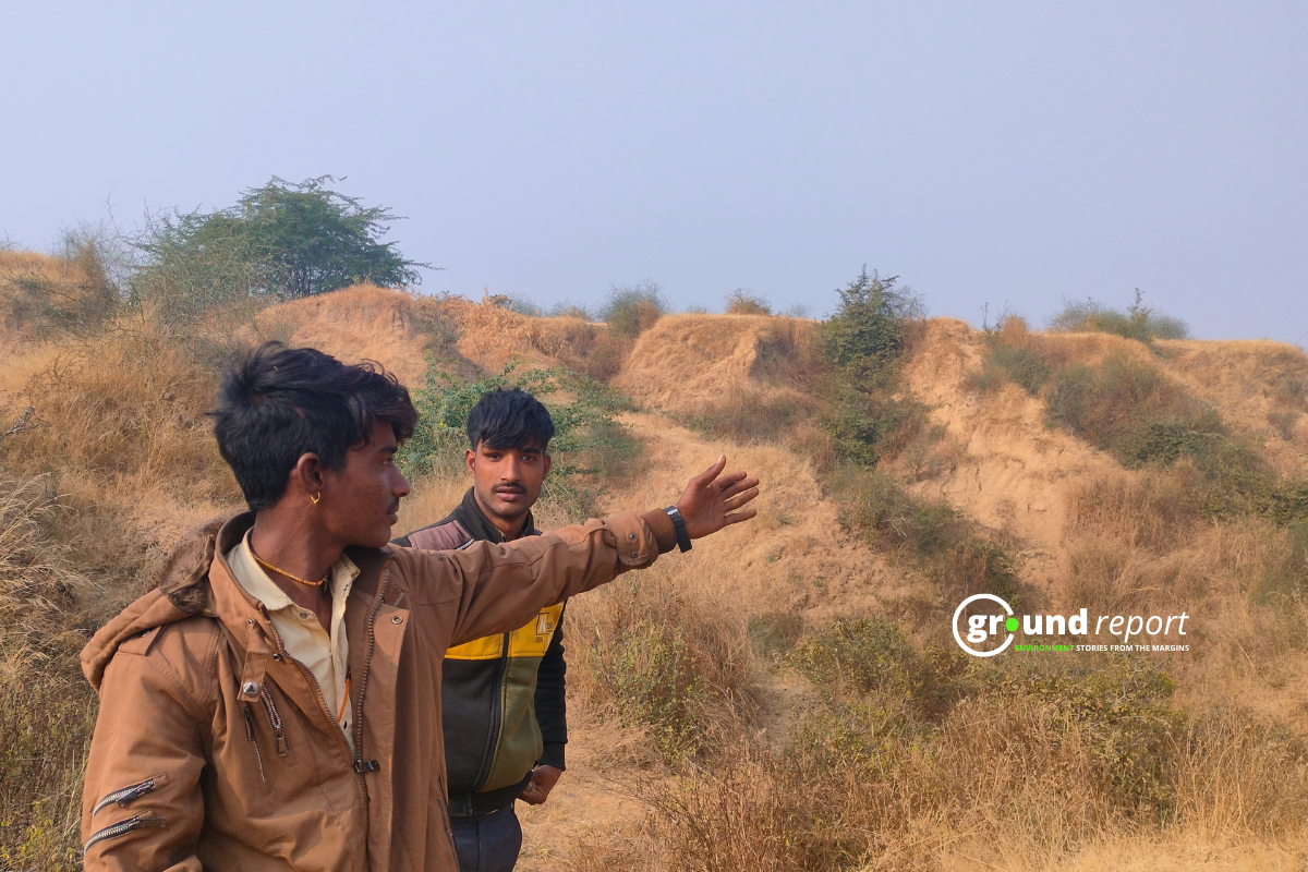
Fields of yellow mustard sway in the cool December breeze, stretching across the uneven terrain on the way to Mrigpura village. Among the fields, mounds of earth or Beehad, emerge, suggesting that this area may have once been a wild, rugged landscape.
Twenty-three kilometres away from Morena, a town in Madhya Pradesh, locals in the village have secured land leases for these rugged Beehad for agriculture. Land leases are done through the Patta system in the region. A land deed system that involves the government granting land to individuals or organisations for agricultural purposes. This has led to legal and illegal farms disrupting the natural ecosystem and increased soil erosion.
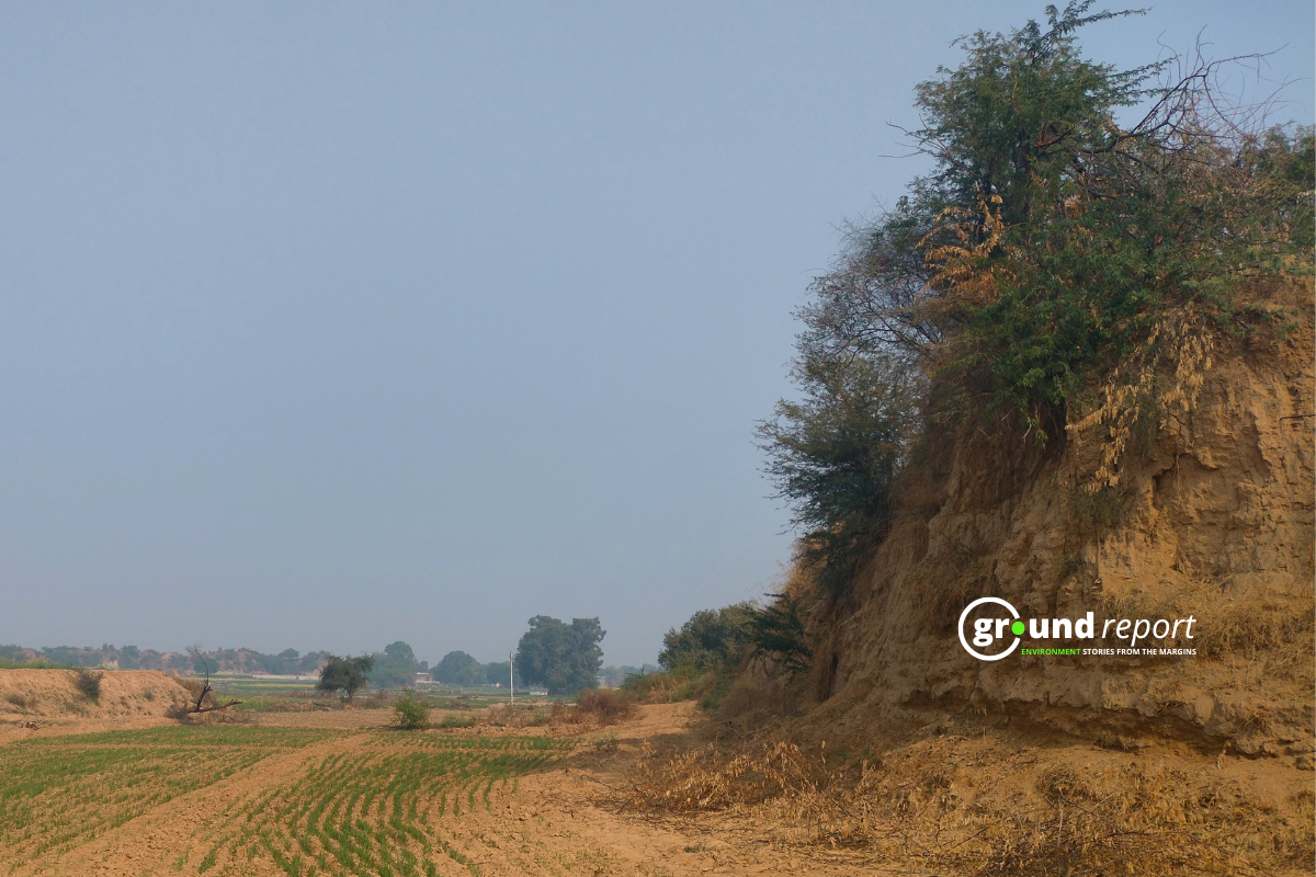
In the local dialect, ‘Beehad’ often signifies a wild, ungoverned stretch of land, reflecting both its natural beauty and the inherent danger it poses due to its isolation and difficult geography.
Chambal, renowned for its Beehads, carries a notorious reputation in Indian history. Once associated with bandits, the valley has long been linked to fear. Yet, despite its dark past, these rugged lands host one of the world’s most unique and charismatic ecosystems. In recent years, however, a decline in vegetation cover has exacerbated soil erosion, leading to the formation of potholes and ditches. The resulting topography, marked by these deep drains and ravines, is what is often referred to as ‘rugged’ or beehads.
Soil erosion in Chambal is rapidly worsening, threatening agriculture and biodiversity. The leveling of rugged terrain for farming has led to increased erosion, loss of native plants, and displacement of animals. While government efforts to reclaim land are underway, experts warn that improper management could worsen the environmental crisis. Small farmers are particularly struggling with rising reclamation costs and the ongoing erosion of their lands.
Highlighting the issue of soil erosion, Mrigpura Sarpanch (village head) Ranjit Parmar explains that the wilderness between the Kwari and Chambal rivers has nearly vanished. Even the remaining wilderness along the Chambal River is gradually being leveled by locals. In his native dialect, he expresses his sorrow, saying, “Ab hamn to bihad kaun dikhan na rao, sab aadmiyan nai tod lao,” which roughly translates to,
“Now, we don’t see any wilderness left; all the people have destroyed it.”
Dr. Sandeep Tomar, the co-director of the Morena Zonal Agriculture Research Center, explains the factors behind the formation of rugged terrain in the area. He points out that the Chambal River flows significantly lower than the surrounding plain land. When it rains, water from the flat land rapidly flows toward the river from higher ground, carrying a large amount of soil with it. He adds that the soil in this region contains a high amount of sand, which makes the area appear flat from above. However, beneath the surface, the soil moves, causing the ground to settle and leading to the formation of ruggedness.
Tomar further explains that increased animal grazing and tree cutting by the local community have exacerbated soil erosion. The once-pristine rugged landscapes of Morena, Sheopur, and Bhind—identifying features of the district—have now become a significant problem.
Soil erosion has become a major concern in the region. Several villages around Mrigpura, including Mauakhera, Gorkha, Gadora, Ratanbasai, Ajitpura, Kharauli, Jaghona, Rithona, Mahuva, Sarsani, and Gaushpur, have been forced to relocate due to the impact of erosion.
Padmini Pani, a professor at Jawaharlal Nehru University (JNU), has also raised concerns about the levelling of rugged terrain in an article. The article highlights that over the past 40 years, approximately 600 square kilometres of eroded rugged land in the Chambal region have been levelled, with land levelling activities intensifying in the last decade.
According to an estimate made by the National Commission on Agriculture, India has 36.7 lakh hectares of fallow land which is 1.12 per cent of the total geographical area. About 3.5 lakh acres of land in Uttar Pradesh and about 8 lakh acres of land in Madhya Pradesh, Rajasthan and Gujarat are badly affected by the erosion of rugged or ravines.
In Bhind and Morena districts, ravines have swallowed many villages and communities, destroying their homes and ruining the soil. The deluge is estimated to have affected 948 villages in the two districts. The Chambal division has an area of 16.14 lakh hectares. Of this, about 3.107 lakh hectares (20%) is rugged.
Flattening the beehad and the biodiversity
According to Bhura Gaikwad, the sub-divisional officer (SDO) of the Morena Forest Department, the leveling of the Behad is posing a serious threat to the region’s biodiversity. The Behad serves as the habitat for species such as the blue cow, golden jackal, wolf, wild boar, and Asiatic caracal, all of which are being displaced due to the ongoing land leveling.
Plants like google (Commiphora wightii) and karund (Carissa carandas) help in stopping the erosion of the rugged. But local farmers are also removing them by leveling the terrain.
Government officials, like Gaikwad, seem unable to provide a concrete answer when asked how much of the Behad has been leveled.
“Some of the land is under the forest department’s ownership, and we cannot estimate the extent of rugged land leveling that has occurred in the Chambal region,” he says.
However researcher Vikram Ranga, from Jawaharlal Nehru University who has analysed data from 1971 to 2010 has found that the area of Behad has reduced by 20%.
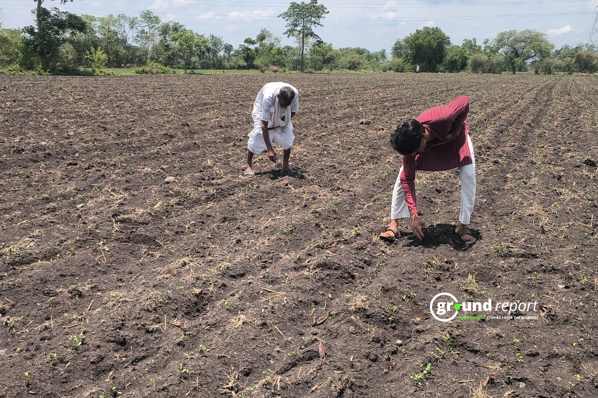
In Ratanbasai village, soil erosion has become a significant problem for Pancham Singh (37), a farmer with a small holding of five bighas.
“All the fields to the east and north of the village are affected by rugged terrain. Some large farmers have leveled the land and built embankments, but for a small farmer like me, this work is very challenging,” Singh explains.
In fact, it costs about one and a half lakh rupees to level just one bigha of rugged land. Along with this, the expenses for creating embankments and filling in the erosion every year become too costly for small farmers. According to Singh, larger farmers are able to expand their land holdings by taking more and more land.
Plight of farmers is worse according to Dr Tomar. He explains,
“If the leveled land is not managed properly or if concrete fencing is not done, the agricultural land will be eroded rapidly.”
In fact, as a result of poor management in the Chambal, land degradation went from bad to worse. A network of drains turned into a network of deep and very deep drains. It is still moving unabated in the form of deep and large trenches. Despite this, lakhs of rupees have been spent on levelling, fencing and aerial spraying of seeds for afforestation. The fact is that the infallible technology for the retrieval and control of very deep trenches is not yet available.
Dwarka Singh from Piprai village recalls the stories of his village from 60 years ago. He shares,
“The area where the deep gorge is visible today was once flat. The village’s Holi was celebrated there, and we used to bring water from the Chambal River by loading matkas onto bellows, as there was no water in the village. There was a direct road from the river to the village, but now that road has turned into deep ravines and drains.”
“But the government never paid any attention to the issue,” he adds. The government introduced Vilayati Babul (Prosopis Juliflora) in 1980, but with its spread, local vegetation and grass were destroyed, and erosion worsened. “No concrete steps have been taken by the government,” he laments.

What did the government do?
The state government sees this as an opportunity. In 2020, Narendra Singh Tomar, the then Union Agriculture Minister and current Vidhan Sabha Speaker, who hails from the Gwalior-Chambal division, held a high-level meeting with senior officials from the Madhya Pradesh Agriculture Department, academicians, and representatives from the World Bank. The meeting focused on preparing a project report on how the rugged terrain could be reclaimed and leveled for agricultural use.
Tomar believed that 300,000 hectares of rugged land, which were not suitable for cultivation, could be made productive, contributing to the integrated development of the Gwalior-Chambal region.
Before this, an attempt to ‘develop’ the Chambal ravines was made in 2015 when the then Chief Minister Shivraj Singh Chouhan’s government presented an ambitious plan to the Union Ministry of Agriculture to level the Chambal ravines and make them suitable for agriculture.
While the government is working on leveling the ravines, the Sujagriti Samaj Sevi Sansthan is focused on increasing vegetative density in the region to halt the spread of the ravines. Zakir Hussain from the organization tells us that they have planted Google plants over 10 hectares in the Piprai ravines. In addition, they have also planted Shatavari.
Zakir explains the reasoning behind these efforts, saying,
“Since Google is a good soil-binder plant, it helps prevent erosion in the ravines. We are also planting several other medicinal plants on the field boundaries and in the ravines, which will stop erosion and provide local communities with economic benefits from the sale of these medicinal plants.”
For the past 20 years, the Mogi indigenous community in Piprai village has been conserving Google plantations and earning their livelihood through sales.
Zakir further explains that in 2013, the fields in Piprai village were severely affected by soil erosion and were on the verge of becoming part of the ravines. However, with the help of the Center for Science and Education, their organization succeeded in managing the situation.
Their organization constructed concrete drainage systems in the fields. Permanent drainage channels were created to direct rainwater away from the fields, benefiting farmers and preventing their land from becoming part of the ravines.
However, the issue of land levelling cannot be overlooked. Many fields here are still affected by soil erosion. This situation serves as an example of how attempts to alter natural landscapes can be dangerously impactful.
Story Edited by Diwash Gahatraj
Keep Reading
MP’s forest villages: land rights promise lost in bureaucratic maze
Farmers prevent soil erosion through bamboo plantation
Will Pithampur become another Bhopal? Toxic waste disposal spark fears
Eclogical impacts of linking Parbati, Kalisindh, and Chambal Rivers
Check out Climate Glossary to learn about important environmental terms in simple language.
Support us to keep independent environmental journalism alive in India.
Follow Ground Report on X, Instagram and Facebook for environmental and underreported stories from the margins. Give us feedback on our email id greport2018@gmail.com.
Don’t forget to Subscribe to our weekly newsletter, Join our community on WhatsApp, Follow our Youtube Channel for video stories.