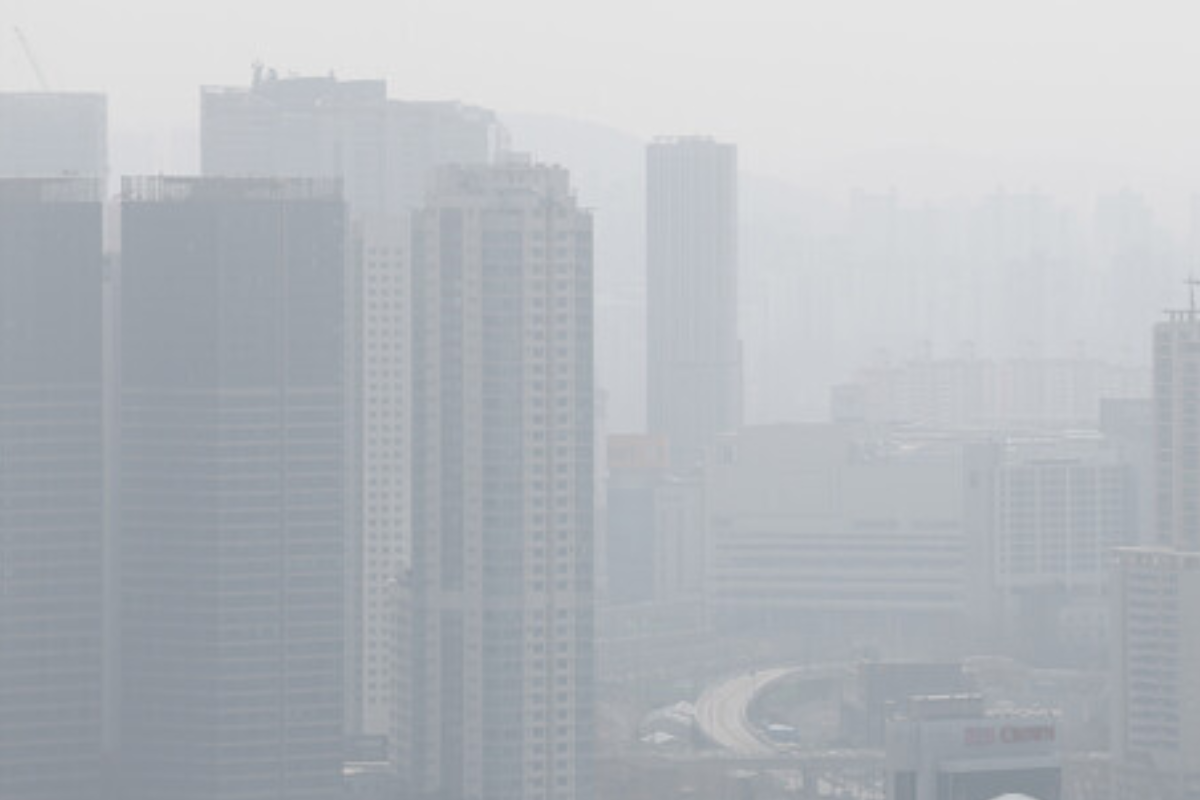
On Thursday, April 17, temperatures across South Korea will vary by about 15 degrees Celsius between day and night. Yellow dust, originating from the Gobi Desert, has started to move over the country, bringing with it an increase in fine dust (PM10) concentrations. The Korea Meteorological Administration (KMA) predicts that the concentration of fine dust may rise on the 17th and 18th due to this influx, especially in the central and western regions.
The KMA forecasts variable air quality, depending on the amount of yellow dust and changes in air currents. Air Korea has predicted that PM-2.5 levels will be high in the central and western regions starting in the afternoon of April 17. PM-10 levels are expected to rise in some eastern regions as yellow dust moves in.
Rain is expected to start on the weekend. On April 19, the KMA forecasts rain in northern Gyeonggi Province and northwestern Gangwon Province, which will gradually spread to other parts of the central region, Gyeongnam Province, and Jeju Island by afternoon. By evening, rain will cover most of the country.
The day’s temperatures will be 2 to 6 degrees higher than average. The lowest temperatures in the morning will range between 4 and 11 degrees, while daytime highs will range between 17 and 22 degrees.
On April 17, Seoul will see a high of 24 degrees, while areas like Daejeon, Cheongju, Gwangju, and Jeonju will experience highs around 27 degrees. Coastal areas like Busan and Jeju Island will remain cooler, with temperatures expected to be around 19 degrees. The temperature difference between day and night will be noticeable.
The Korea Meteorological Administration has also reported that some areas in southern Gangwon and northern Chungcheongbuk-do may see light rain today, with amounts less than 0.1mm. On April 19, rain is expected to start in northern Gyeonggi Province and expand to the central region, Gyeongnam Province, and Jeju Island by the afternoon.
The expected precipitation for the weekend is as follows:
-
Seoul and Gyeonggi Province: 5 to 20mm
-
Gangwon Province: 5 to 20mm, with coastal areas receiving around 5mm
-
Daejeon and Chungcheong Province: 5 to 10mm
-
Gwangju and Jeolla Province: less than 5mm
-
Busan, Ulsan, and Gyeongsang Province: less than 5mm
-
Jeju Island: 5 to 10mm
Strong winds are expected along the southern west coast of Jeollanam-do, where a strong wind advisory has been issued. Winds may reach speeds of 70 km/h (20 m/s) or more, with higher gusts in mountainous regions. Winds will also be strong in northern Jeju Island and its mountainous areas until the morning of April 18.
For the next few days, South Korea will experience a mix of high and low pressure systems. On the 17th, a low-pressure trough from northeastern China will affect the metropolitan area and Gangwon-do, while the 19th will bring a low-pressure trough from near the Shandong Peninsula in China. By April 20, the country will move out of the low-pressure zone and be affected by high pressure from the West Sea to the East Sea.
As we move through the week, residents should be prepared for changes in air quality and temperatures due to the influence of yellow dust and varying weather conditions.
Support us to keep independent environmental journalism alive in India.
Keep Reading
‘Forever Chemicals’ found in all the world’s toilet paper
Trump shuts down staff helping families pay heating bills
Full list of words banned by Trump, including ‘Climate Change’
Oil companies seek Trump’s help to fight climate lawsuits & regulations
Follow Ground Report on X, Instagram and Facebook for environmental and underreported stories from the margins. Give us feedback on our email id greport2018@gmail.com.
Don’t forget to Subscribe to our weekly newsletter, Join our community on WhatsApp, and Follow our YouTube Channel