Japan is preparing for what could be the strongest typhoon in 64 years. Typhoon Shanshan, currently a Category 4 hurricane, is expected to hit next Tuesday with maximum sustained winds of 140 mph (225 km/h). Some models suggest it could become a Category 5 storm upon landfall.
The Japan Meteorological Agency (JMA) reported that Typhoon Shanshan became a “strong” typhoon on Saturday morning. The atmospheric pressure dropped to 980 hPa and maximum wind speeds reached 35 m/s (126 km/h) at its center. The storm is currently tracking northward over the sea near the Ogasawara island chain at 25 km/h.
According to the JMA, Shanshan is expected to approach Kyushu and Shikoku by 9 a.m. on Tuesday. The typhoon’s central atmospheric pressure is predicted to fall further to 950 hPa, with maximum wind speeds at the center estimated to reach 45 m/s (162 km/h). The agency has classified the typhoon as “very strong” as it approaches landfall.
🚨🇯🇵 POWERFUL TYPHOON TO HIT JAPAN, STRONGEST IN 64 YEARS
A catastrophic typhoon, equivalent to a Category 4 hurricane, is forecasted to strike Japan next Tuesday, potentially becoming the strongest to hit the nation’s main islands in 64 years.
The storm is expected to make… pic.twitter.com/FJMjqUNJus
— Mario Nawfal (@MarioNawfal) August 24, 2024
The JMA has issued warnings for lightning, gusts, hail, and torrential rain over the weekend as the storm’s outer bands interact with warm air near a high-pressure system. Tokyo and surrounding areas have already experienced heavy rains, leading to road flooding and train disruptions.
Operators of the Tokaido, Sanyo, Joetsu, and Hokuriku Shinkansen bullet trains have indicated possible cancellations or suspensions on Tuesday and Wednesday due to the storm. This could mirror the disruptions caused by Typhoon Ampil last week, which led to the suspension of many bullet train services, including a full-day halt on the Tokaido Shinkansen Line between Tokyo and Nagoya on August 16. The disruption affected thousands of tourists and travellers during the busy summer holiday season. Additionally, around 650 international and domestic flights were cancelled at Tokyo’s Haneda and Narita airports.
As of Saturday afternoon, Shanshan was a strong storm with a central atmospheric pressure of 980 hPa, sustained winds of 126 km/h, and peak gusts of 180 km/h. The JMA predicts that the typhoon will intensify approaching the Shikoku region on Tuesday. Sustained winds could potentially reach 162 km/h and peak gusts of 216 km/h.
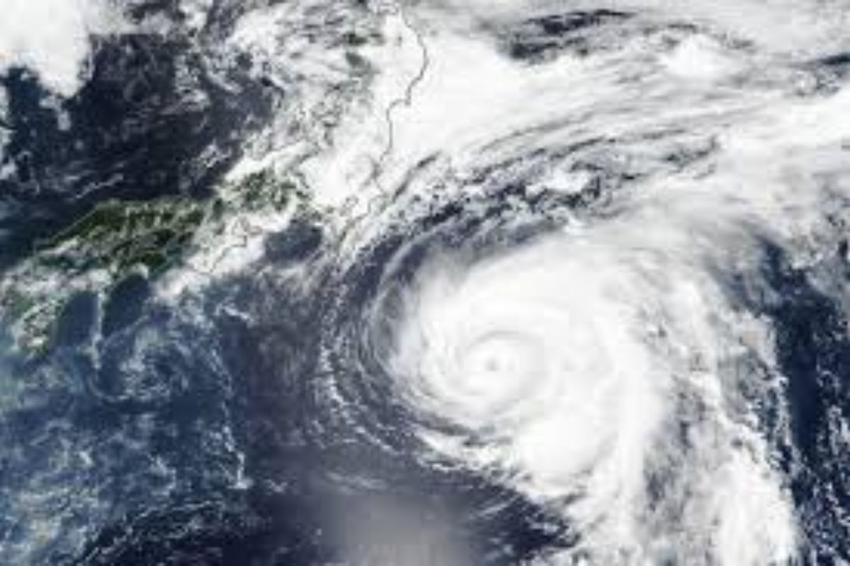
Satellite imagery shows the storm’s increasing strength, with a well-defined eye indicating no significant obstacles to weaken it. The storm’s cohesion and size suggest it could cause widespread damage upon landfall.
Typhoon season runs year-round, but most typhoons form from early July through mid-December. Japan, the Philippines, and Taiwan are frequently affected, with occasional impacts on the Korean Peninsula, China, Vietnam, and U.S. territories like Guam. Last year, Super Typhoon Mawar devastated Guam, causing billions in damage.
Keep Reading
Indian agriculture household earns just Rs. 10,218 in a month: Govt
Post-harvest losses still high, reveals data shared in Lok Sabha
Support us to keep independent environmental journalism alive in India.
Follow Ground Report on X, Instagram and Facebook for environmental and underreported stories from the margins. Give us feedback on our email id greport2018@gmail.com.
Don’t forget to Subscribe to our weekly newsletter, Join our community on WhatsApp, Follow our Youtube Channel for video stories.


