Hurricane Milton has intensified into a Category 5 storm, moving across the Gulf of Mexico. As of Tuesday evening, it’s on a direct path towards Florida’s west coast, with residents bracing for a catastrophic event. Communities, including Tampa Bay, have begun mass evacuations, clogging highways as they prepare for Milton to make landfall late Wednesday night.
BREAKING: The storm surge for Hurricane Milton is expected to be 15 feet.
To give you an idea of how deadly this is, here’s what 9 feet looks like:pic.twitter.com/0SxfrA9XK3 https://t.co/56ZLtpOIbi
— Financelot (@FinanceLancelot) October 8, 2024
Hurricane Milton is now a Category 5
“Milton is expected to remain a dangerous major hurricane as it approaches the west-central Florida coast on Wednesday night,” the National Hurricane Center (NHC) warned.
Meteorologists have described Hurricane Milton as one of the most dangerous storms in recent central Florida history. CBS News meteorologist Nikki Nolan reported the latest forecast predicts the hurricane will make landfall near Sarasota, Florida, between Wednesday night and Thursday morning. This delay is due to the storm slowing down across the Gulf of Mexico.
The NHC emphasized that all preparations should be completed as soon as possible, particularly in storm surge-prone areas. The hurricane could bring 10 to 15-foot storm surges along parts of the Gulf Coast, including Tampa Bay, if the peak surge coincides with high tide.
You realise Hurricane Milton is not the end game? Its just the beginning… pic.twitter.com/gwnX2Fqlyn
— Matthew Todd 🌏🔥 (@MrMatthewTodd) October 8, 2024
“Hurricane Milton could be one of the most destructive hurricanes to hit west-central Florida,” the NHC said.
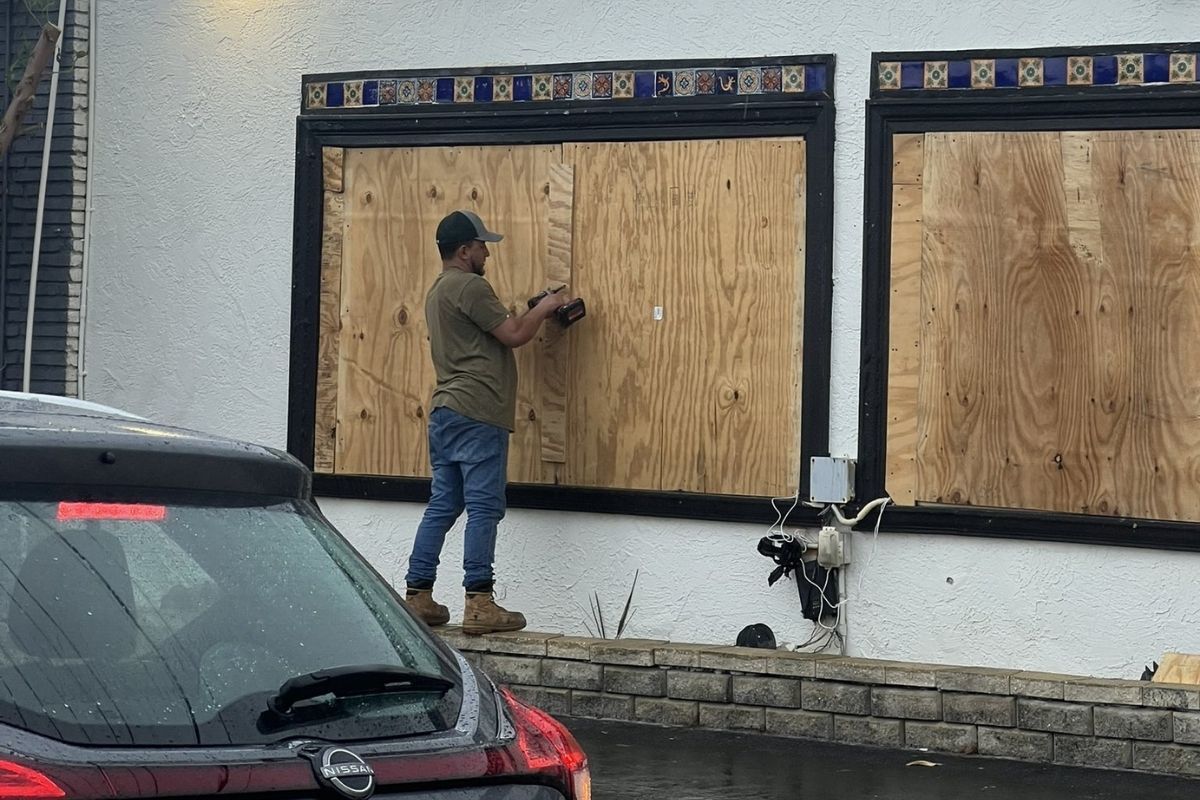
Floridians in Milton’s path are acting swiftly. Sandbags are being placed around homes and businesses, windows are being boarded up, and boats are being secured. Governor Ron DeSantis issued emergency orders for 51 counties, urging residents to prepare for power outages and stock up on food and water.
“As of Tuesday evening, over 17% of Florida gas stations were out of fuel, with over 46% in the Tampa Bay area,” according to GasBuddy.
The NHC emphasized the seriousness of the situation and urged people to leave if local authorities so instructed. “There likely won’t be enough time to leave on Wednesday,” the NHC said, highlighting that Milton poses “an extremely life-threatening situation” for those in storm surge zones.
Hurricane warning issued for central Florida
A hurricane warning is in effect for central Florida, from the Gulf to Atlantic coast, including Tampa, Fort Myers, Orlando, Cape Canaveral, and Daytona Beach. Hurricane-force winds over 74 mph are expected within 36 hours.
A storm surge warning is in place along the Gulf Coast from Flamingo to the Suwannee River, including Charlotte Harbor and Tampa Bay. A similar warning covers Florida’s Atlantic coastline from Sebastian Inlet to Georgia’s Altamaha Sound. These regions are at risk of life-threatening water level rises.
Over the next 12 hours, the hurricane may fluctuate in intensity but remain a significant threat near Florida. Milton is expected to weaken slightly before landfall due to increasing wind shear, but it will bring destructive winds, storm surges, and flooding. As Milton grows larger, its impacts will spread across a wider area, affecting regions inside and outside the forecast cone.
The International Space Station just orbited above Hurricane Milton as it is re-intensifying over the southern Gulf of Mexico.
Spectacular view from space. pic.twitter.com/KDShU0qZIN
— Nahel Belgherze (@WxNB_) October 8, 2024
Storm surge is expected to build up on Wednesday, peaking Wednesday night into Thursday morning. On Wednesday afternoon, there will likely be a low tide along Florida’s west coast, and on Thursday morning, there will likely be a high tide, which could amplify the storm surge effects.
Milton increases flood risk in Florida
Milton’s heavy rainfall poses a significant flood risk for central and northern Florida. A stationary front has been pouring rain on Florida since the weekend, increasing the threat. The National Weather Service has issued flood watches across much of the Florida Peninsula in preparation for Milton’s arrival.
Central and northern Florida are expected to receive 6 to 12 inches of rain, with some areas seeing up to 18 inches by Thursday. This could lead to flash flooding and river flooding, with the NOAA’s Weather Prediction Center issuing a rare “high risk” flood threat for parts of central Florida, including Tampa and Orlando.
As Milton approaches, its strongest winds are forecast to hit central Florida late Wednesday, particularly around Sarasota and Tampa Bay. The NHC warns these winds could down trees and cause structural damage, leaving large areas without power for days.
Hurricane Milton is expected to bring a destructive storm surge to Florida’s west coast. @StephanieAbrams uses our FloodFX simulation technology to show you what that could look like ⬇️ pic.twitter.com/rg996zNHy2
— The Weather Channel (@weatherchannel) October 8, 2024
The storm’s effects will spread east across central Florida from Wednesday night to Thursday. Even areas farther from the storm’s landfall, including northern and southern parts of the state, will likely experience strong wind gusts, causing scattered power outages.
Despite forecasts indicating Hurricane Milton might weaken slightly before landfall, the NHC has urged residents to stay vigilant. The storm’s size means widespread and severe impacts, including life-threatening storm surges, destructive winds, and excessive rainfall.
“This is a serious threat to Florida, and all precautions should be completed before Wednesday afternoon,” the NHC stated.
Support us to keep independent environmental journalism alive in India.
Follow Ground Report on X, Instagram and Facebook for environmental and underreported stories from the margins. Give us feedback on our email id greport2018@gmail.com.
Don’t forget to Subscribe to our weekly newsletter, Join our community on WhatsApp, Follow our Youtube Channel for video stories.
Keep Reading
Gujarat: 38 Animals, birds die at Statue of Unity complex in 2 years
18 billion animals sacrificed yearly without making it onto someone’s plate: Study
Living planet report: Global populations of wild animals declined 69% in 50 years