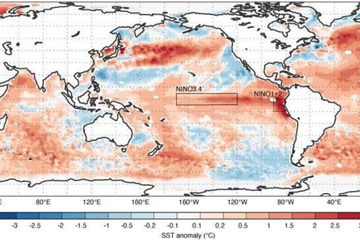
The presence of the El Niño meteorological phenomenon is indisputable, as evidenced by the temperature anomalies observed in the Pacific Ocean. The extent and duration of its impact remain uncertain. Weather forecasters paint a bleak picture, with some predicting a significant rise in sea surface temperatures associated with El Niño, which could exceed 3 degrees Celsius.
Significance of El Niño events
El Niño is characterized by prolonged periods of unusually high sea surface temperatures in the tropical Pacific Ocean. It triggers atmospheric changes and can have far-reaching effects on global weather patterns. Also, El Niño can significantly influence global warming by affecting the global average temperature.
Current measurements indicate above-average temperature anomalies in the tropical Pacific, and all seasonal forecasts suggest a likely continuation of this upward trend in the coming months. However, there is considerable uncertainty surrounding the intensity of the impending event.
New forecasts from eight global meteorological organizations, including the European Center for Medium-Range Weather Forecasts (ECMWF), project a further increase in temperature anomalies within El Niño-affected regions over the next six months.
While these forecasts generally align with the overall trend, there is significant variation between them, leading to slight discrepancies in the average values forecast by different forecast systems.
Significance of El Niño events
According to the Climate Change Service’s analysis, most forecasts indicate a sea surface temperature anomaly ranging between 1 and 2.5 degrees Celsius, with some scenarios even reaching 3 degrees Celsius, until November of this year.
During El Niño events, global average temperatures generally increase in the year following the peak of the event. The World Meteorological Organization (WMO) predicts that global temperatures will reach record levels in the coming years.
Strong El Niño episodes also cause notable changes in weather patterns, particularly in areas near the tropical Pacific. Eastward movement of warm surface waters in the tropical Pacific results in above-average pressure and reduced precipitation in the western Pacific, while the eastern Pacific experiences lower pressure and increased precipitation.
El Niño events also influence climate anomalies around the world, although their impact on Europe remains uncertain, according to the researchers.
The ECMWF, a European center for weather forecasting, also provides 13-month forecasts in February, May, August and November. The May forecast suggests that the El Niño event is likely to dissipate early next year, with a small chance that it will continue well into 2024.
Previous strong El Niños, such as those in 1997 and 2015, dissipated relatively quickly the following year, forecasters say.
Keep Reading
Part 1: Cloudburst in Ganderbal’s Padabal village & unfulfilled promises
India braces for intense 2024 monsoon amid recent deadly weather trends
Support us to keep independent environmental journalism alive in India.
Follow Ground Report on X, Instagram and Facebook for environmental and underreported stories from the margins. Give us feedback on our email id greport2018@gmail.com.
Don’t forget to Subscribe to our weekly newsletter, Join our community on WhatsApp, and Follow our YouTube Channel for video stories.


